
With the hope that I would be able to soak up some vivid memories of stunning autumn landscapes as a kind of battery recharge for the greyness, the dampness and the chilliness we shall soon be having to put up with in two to three weeks’ time from now (if not earlier as the first snowfall in our area could be for this Friday already), I decided to go to Zermatt on Sunday with the intention of running through its luxuriant forest to reach the mountain of Riffel and then the lake of the same name, where on a nice day the reflection of the Matterhorn on the water makes for the postcard view you have surely all seen (if not click here).

Although Zermatt is not my favourite mountain resort in Switzerland, I must concede that the centre of Zermatt is usually full of visitors strolling along the main street, Bahnhofstrasse, which is lined up with all sorts of shops meant to cater to their needs, and that, therefore, the overall impression is that the place is bustling with activity (I made sure there would be as few passers-by as possible on my pictures though). As I tend to dislike all architecture after WWII, I thought that I had to document my trip in the area with a picture showing more traditional houses and thus I quickly went to the beginning of Hinterdorfstrasse to take the shot I have included on the bottom left of the montage just above.
 [Click to enlarge]
Before that, I came across one of Zermatt’s many tennis courts – surely, an indication of the type of visitors who patronise the resort (and maybe also why the village itself does not make it to the top of my list of favourite alpine resorts), no? However, as an aside, what I really do like about Zermatt is that cars with combustion engines are not allowed in the village – so that only electricity-powered vehicles are to be seen on the roads of this village (to the extent that even the police car is a little different from the type of police cars you would see elsewhere in Switzerland). What I like most, of course, are the many beautiful mountains that surround the village. Zermatt tourism claims that ‘almost one third of the 4,000-metre mountains in the Alps are grouped around’ the village, which certainly explains why it has become so famous and popular with tourists as well as with mountain climbers, skiers and riders of mountain bikes.

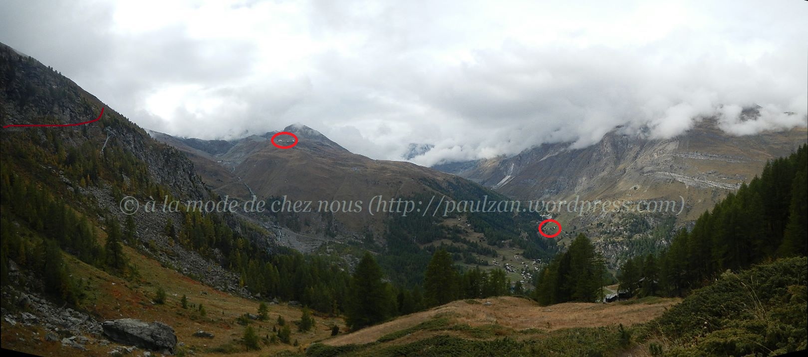
Anyhow, leaving aside such considerations, I cut across the village and jogged until I reached Winkelmatten (1,672m); from there it took me no more than ten minutes to be in the woods. This was the start of my long climb towards the lake of Riffel. At some point, i.e. somewhere in between In den Bächen and Untere Riffelalp, the hamlet and the dam of Zmutt became visible in the far distance (almost smack in the middle of this picture) through the larches. This brought back some nice memories of a trip my wife and I had made to that part of the region two years ago (see my wife’s account here).

Then it was a matter of keep walking briskly (as, in all honesty, I cannot claim that I kept running all the way up – I am not that fit unfortunately) through Vorderi Wälder, the large expanse of woods (mostly larch trees and some arole pines) that extends well over 2,100 metres of altitude – which seems higher than in the other valleys I have been to in the canton of Valais.

The building on the left, a restaurant called Chämi Hitta, stands at 2,114m; it is situated below a hamlet called Riffelalp (which is why this particular spot is called Untere Riffelalp in German). As you can see, there are trees above this hamlet. Before leaving home I had only given a cursory look at the online version of the map of the area published by Swisstopo (which is part of the Federal Office of Topography); at Zermatt, I had picked up a free map outside of the tourism office, but it was not sufficiently detailed. In particular, I did not know at this point whether I ought to try to follow the rail track (the dark line visible above the red line I have jotted on this photograph) and cut through the mountain or follow my intuition and head to the right, along the side of the mountain. I went for the latter but my intuition proved me wrong at least with regard to the shortcut I followed (see the straight line running upward): the field I climbed was quite boggy, so that I got my feet all wet and they remained so until I reached home, more than seven hours later.
[Click to enlarge]
Once I had managed to ‘escape’ from this boggy area, I saw a path which I then went on. A few minutes later, I caught sight of this beautiful view. Not only the hamlet and the dam of Zmutt were visible on the right (see the circle for the hamlet), but I could also see Hörnlihütte (3,260m), the base camp as it were for the mountaineers who climb the Matterhorn (left circle), which I had hoped to reach two years ago (read account here). As you can see from this picture, the Matterhorn was not visible on Sunday as Hörnlihütte is located right at the foot of this famous mountain (on the so-called lion’s ridge).

I carried along a relatively flat stretch until the path zigzagged upwards. The path had been consolidated through some masonry work. It is always reassuring while walking (or running) on such alpine paths to see that some people have felt sufficiently concerned about your safety to have actually done something about it, no?
 [Click to enlarge]
Maybe a hundred metres higher up and I was able to admire another sweeping view of the valley below me with (starting from the left) the mountain regions of Höhbalmen, Chüeberg, Äusserberg, Mattertal (the valley itself), Zermatt and, above it on the right, the hamlet with the restaurant Chämi Hitta and then the tiny ‘resort’ of Riffelalp.
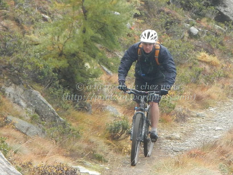
A little after I came across a mountain biker, who greeted me ‘hello’. I somehow envied him when I saw him cycling downhill almost at full speed given that I had been going uphill for almost two hours. Just like many other mountain resorts in Switzerland, Zermatt has decided to expand its customer base and attract in summer mountain bike enthusiasts with about 100km of cycling paths.

A little further along the path I was able to enjoy another deep view down into the valley of Matter. From this vantage point (although I zoomed in to take this photo), the village of Zermatt certainly seemed to be sprawling across most of the valley. If you look carefully, you will notice that there are several construction cranes, so that the area is likely to become dotted with even more chalets in the near future.

As I had not come on a three-hour long train ride to this region only to muse upon the changing landscape of the village of Zermatt from above the valley of Matter, I quickly resumed my climb, hoping that I would soon be able to see the garden of glaciers (Gletschergarten), even if from a distance, as I was supposed to be following the path leading to the glacier garden (Gletschergartenweg).
 [Click to enlarge]
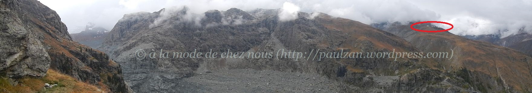
Five minutes later, at last, my first sight of the end part of the glacier of Gorner (and probably a bit of the glacier of Theodule). This was enough to cheer me up, as it had started to drizzle a little and I was wondering whether it might not be safer to start making my way back. However, I also wanted to see more of the glacier, so I decided to carry on. Note that on this panorama Hörnlihütte is visible on the far right, even though it is not more than a small dot.
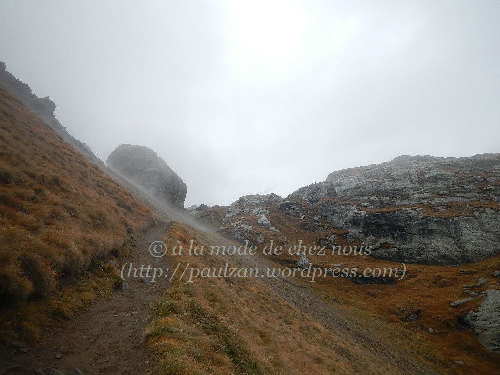
I continued my ascent for about twenty minutes until I saw this huge rock almost emerging from the mist. Although it made the area look forbidding, I pressed on regardless of its presence.
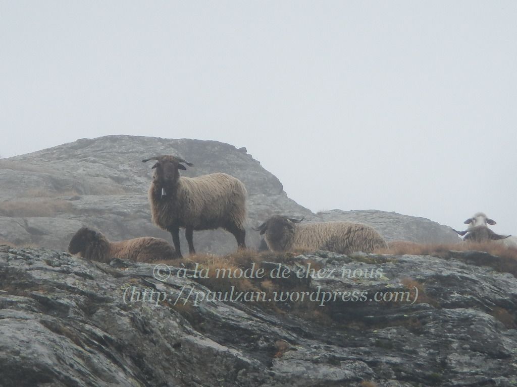
Just opposite this rock, these sheep stopped grazing and looked at me as I approached them, as if they were guarding the area. So was their presence a sign that I would soon be able to admire some breathtaking views (as I had wished I would)?
The answer in Part Two…
Links to previous excursions to this area (wife’s entries with some photos of mine)

Pingback: Matterhorn trail… from Zmutt to Momatt and back to Zermatt… | Just Sharing ...